
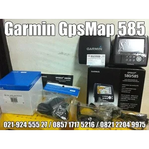


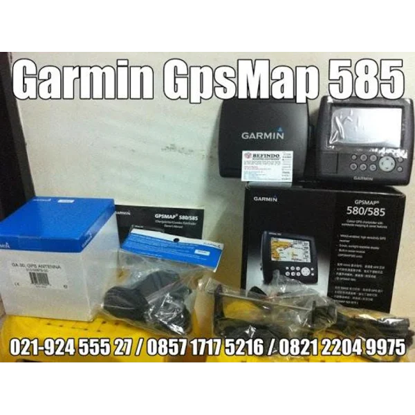
Garmin Gpsmap 585 (Gps Pemeta'an Untuk Mencari Ikan)
Rp 5.600.000
/ unit1 unit
Pembelian Minimum- Stok 212
- Negara AsalTaiwan
- Dikirim DariKembangan, Jakarta Barat
- Kategori
- Update Terakhir16 Mar 2023
Spesifikasi Garmin Gpsmap 585 (Gps Pemeta'an Untuk Mencari Ikan)
Cari berbagai macam dari pilihan terlengkap GPS Dan Navigasi.CV.GPS ONLINE STORE
Authorized Distributors Garmin Gps,
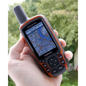
GPSmap 585 is a full-function chart plotter that has an ultra-bright 5 "WQVGA color display along with an improved feature high-speed map drawing and panning. It's ready to go with the easy to use interface and a built-in worldwide basemap. GPS 585 is Garmin unique graphics that not only equip with English but also with Asian languages including Simplified Chinese and Indonesian. the GPSMAP 585 is designed specifically for professional fishermen and equipped with the famous Garmin chart plotters excellence GPS168 / 178C.
* Explore the Seas:
GPSmap 585 module with a built-in high-sensitivity GPS receiver for superior satellite tracking and quicker acquisition. And with an SD card slot, it's easy to add additional maps without connecting to a computer.
Unit dimensions, WxHxD: (15.0 x 16.3 x 7.4 cm)
Display size, WxH: 5 ", 120.7x75.8mm
Display resolution, WxH: 480x272 pixels
Display type: WQVGA
Weight: 390g
Waterproof (IPX7)
Maps & Memory:
basemap
Ability to add maps
Accepts data cards: SD card slot
Waypoints / favorites / locations: 6000
Routes: 150 tracks / 250 points
features:
Supports AIS (tracks target ships position ')
Supports DSC (displays position data from DSC VHF radio)
Audible alarm
Tide tables
Sun and moon information
Dual-frequency sonar
Split-screen zoom
Split-screen sonar / gps
Ultrascroll ™ (displays fish targets at higher boat speeds)
See-thru ® technology (exposes fish hidden in cover)
Fish Symbol ID (helps identify fish targets)
AutoGain Technology (chaos minimize, maximize target)
Whiteline (indicates hard or soft bottom)
Adjustable depth line (measure the depth of underwater objects)
A-scope (real time display of fish passing through transducer beam)
Bottom lock (shows return from the bottom up)
Water temperature log and graph
Water temperature sensor included: (need to equipt with correct tranducer)
sonar:
Frequency: 50/200 kHz
Transmit power: 500W (RMS), 4000 W (peak to peak)
Voltage range: 10-36 VDC
Maximum depth *: 1,500 ft
Cone angle: 20 degrees
* Depth capacity is dependent on water salinity, basic type, and other water conditions.
Garmin original product with 1 year warranty.
for information and reservations please contact our address:
SHOP:
Roxy Square, Lt.LG, Block B9, 21,
Jl.Kiyai Tapa, Grogol, West Jakarta,
contact person:
Add FB: Antonny Yusuf,
Twitter:AntonnyYusuf,
Tel: 021-924555 27,
0857 1717 5216 (I-sat),
0821 2204 9975 (T-Cell),
Fax: 021-5695 3999,
BB Pin: 23513CCF,
Email: [email protected],
https://www.tokogpsonline.com
______________________________________________________________
booking:
- Jakarta area in between the direct payment COD / Transfer.
- Regional Affairs Via Expeditionary Trusted: And TIKI JNE
Minta penawaran sekarang
Joglo, Kembangan, Jakarta Barat, DKI Jakarta

Rp 5.600.000





-1.png)